
Drone Mapping & Digital Documentation
Roof Man View™
Create a repeatable visual record of the roof—not a folder of disconnected photographs.
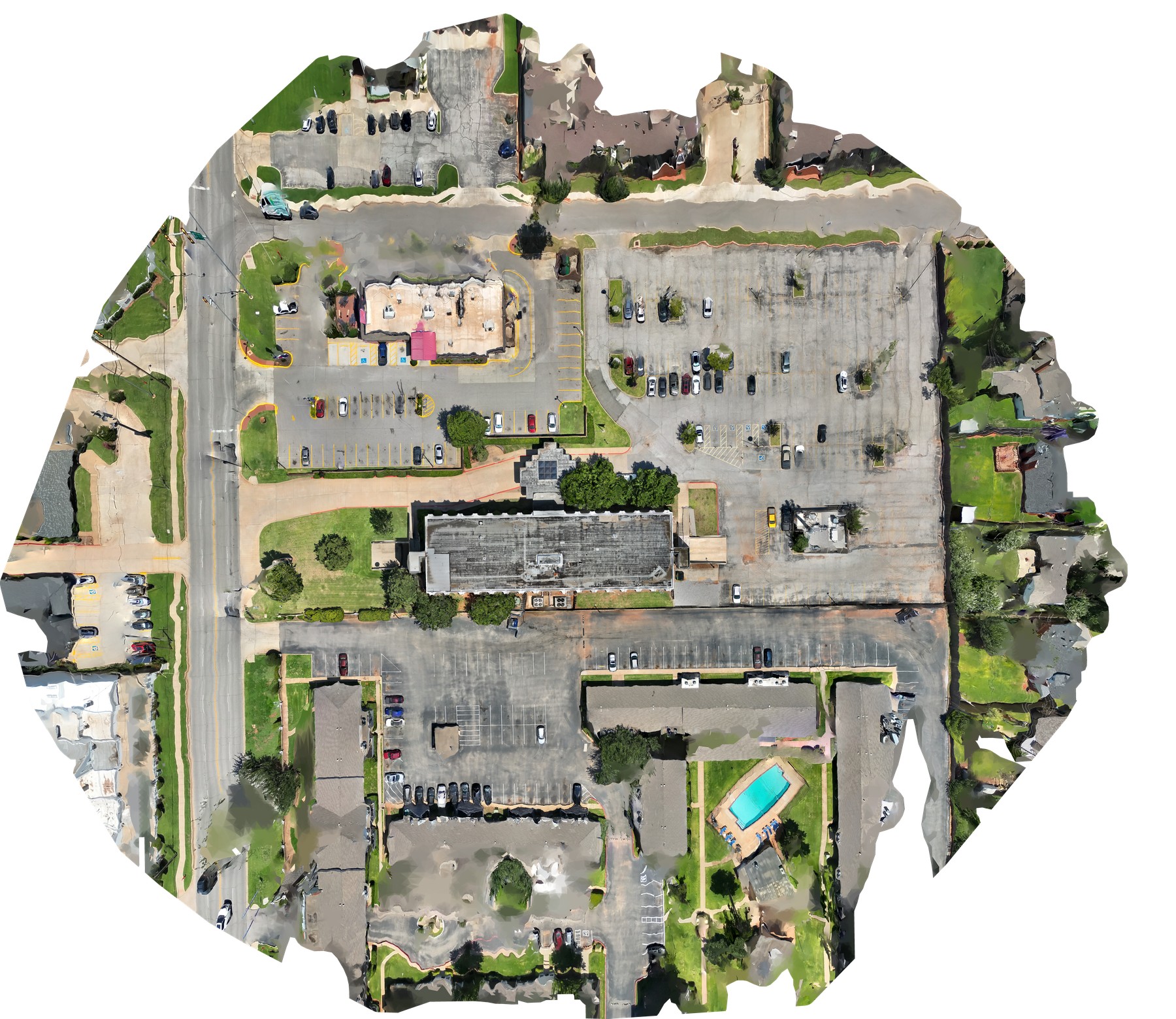
Roof Man View™ provides high-resolution aerial imagery, orthomosaics, measurements, and visual documentation that support planning, communication, and future comparison.
WHAT YOU RECEIVE
Decision-ready information, organized for the next step.
Roof Man View™ provides high-resolution aerial imagery, orthomosaics, measurements, and visual documentation that support planning, communication, and future comparison.
✓High-resolution aerial photography
Why this matters +
What can roof-wide aerial imagery reveal that isolated handheld photographs cannot?
How we helpView™ provides repeatable visual context across the entire roof, helping teams locate conditions, understand relationships, and communicate without relying on memory of where a photo was taken.
Read the related owner guide →✓Orthomosaic roof maps
Why this matters +
Can the entire roof be reviewed on one map-like image instead of hundreds of separate photographs?
How we helpAn orthomosaic combines overlapping imagery into a coherent roof map that can support findings, measurements, repair zones, verification points, and later comparison.
Read the related owner guide →✓Annotated condition locations
Why this matters +
Can a contractor or future inspector find the exact area being discussed?
How we helpConditions can be tied to map locations so repair intent and later verification refer to the same place instead of a vague photograph description.
Read the related owner guide →✓Measurements and area documentation
Why this matters +
Do we need documented lengths or areas before planning scope, quantities, or bids?
How we helpWhere project accuracy requirements allow, mapped imagery can support area and distance documentation that gives planning conversations a clearer dimensional baseline.
Read the related owner guide →✓Repeatable progress or annual views
Why this matters +
Can we show what changed between inspections, repairs, construction milestones, or storm events?
How we helpRepeatable aerial documentation creates comparable visual records that help distinguish new conditions from existing ones and verify completed work.
Read the related owner guide →✓Repeatable roof-area documentation
Why this matters +
Will future teams be able to revisit the same Roof Area with the same visual context?
How we helpOrganized roof-area records keep imagery tied to the permanent asset so later inspections can compare like-for-like locations instead of starting from a new folder of pictures.
Read the related owner guide →HOW IT WORKS
A clear path from project question to usable output.
01Define
Identify roof areas, required outputs, access limitations, and intended use.
Why this step +
Define
Identify roof areas, required outputs, access limitations, and intended use.
Identify roof areas, required outputs, access limitations, and intended use.
Read the related owner guide →02Fly
Collect overlapping visual imagery under site-specific operating and safety constraints.
Why this step +
Fly
Collect overlapping visual imagery under site-specific operating and safety constraints.
Collect overlapping visual imagery under site-specific operating and safety constraints.
Read the related owner guide →03Process
Create orthomosaic maps, measurements, and organized imagery appropriate to the project.
Why this step +
Process
Create orthomosaic maps, measurements, and organized imagery appropriate to the project.
Create orthomosaic maps, measurements, and organized imagery appropriate to the project.
Read the related owner guide →04Deliver
Provide owner-ready visual records that can be used with reports, bids, repairs, or future inspections.
Why this step +
Deliver
Provide owner-ready visual records that can be used with reports, bids, repairs, or future inspections.
Provide owner-ready visual records that can be used with reports, bids, repairs, or future inspections.
Read the related owner guide →COMMON QUESTIONS
What owners usually want to know first.
Is drone mapping a roof inspection by itself?
No. It is a powerful documentation tool but does not replace safe field evaluation where close observation or testing is needed.
Can it help with bids?
Yes. Organized maps and measurements can improve communication and reduce ambiguity.
Can flights be repeated?
Yes. Repeatable documentation can support annual reviews, storm comparisons, progress tracking, and closeout records.
ROOF INTELLIGENCE KNOWLEDGE CENTER
Not ready to schedule? Start by asking better questions.
Use our owner-focused guides to understand moisture surveys, repair versus restoration versus replacement, contractor proposals, lifecycle planning, maintenance, warranties, drone data, and capital decisions.
NATIONAL REACH. OKLAHOMA ROOTS.
Need this information for a real building?
Start with the property, the roof question, and the decision you are trying to make.
Schedule a Roof Evaluation